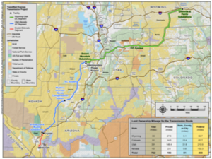
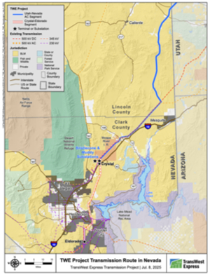
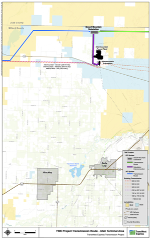
Maps and visuals
The route for the electricity transmission line is approximately 732 miles in length, with a typical right-of-way width of 250 feet. Substations/converter stations will be constructed at interconnection points in Wyoming, Utah and Nevada.
Power line design
Along the route, transmission structure heights may vary from 100 feet to 180 feet depending upon structure type, terrain, span and line crossings. The span between structures may vary from 900 to 1,500 feet. The AC structures will look very similar to the DC structures.
DC line structures

| Single-circuit steel-lattice self-supporting structure |
Single-circuit monopole tubular steel structure |
Single-circuit guyed structure |
|---|
Stay informed
![]() Join TransWest's email list to receive periodic updates and meeting notifications.
Join TransWest's email list to receive periodic updates and meeting notifications.
 Follow us on X/Twitter.
In the news
"Building a more resilient and efficient electrical grid is critical to our success."
- Patricia Hoffman, Acting Assistant Secretary for DOE Office of Electricity, April 22, 2021


